Back to Weather

5-day forecast / Plano, TX

WednesdayCloudy then Chance Showers And Thunderstorms93° / 74° 34%
ThursdayShowers And Thunderstorms84° / 70° 99%
FridayShowers And Thunderstorms81° / 67° 86%
SaturdayShowers And Thunderstorms Likely79° / 66° 65%
SundayChance Rain Showers80° / 63° 37%

Plano’s flood risk shifts toward overnight storms and Thursday

Plano weather, updated every four hours — local forecasts you can trust.

NWS raises localized rainfall potential to 5–7 inches across the watch area; exact neighborhood totals remain uncertain.

Plano Newsroom

September 30, 20261 min read

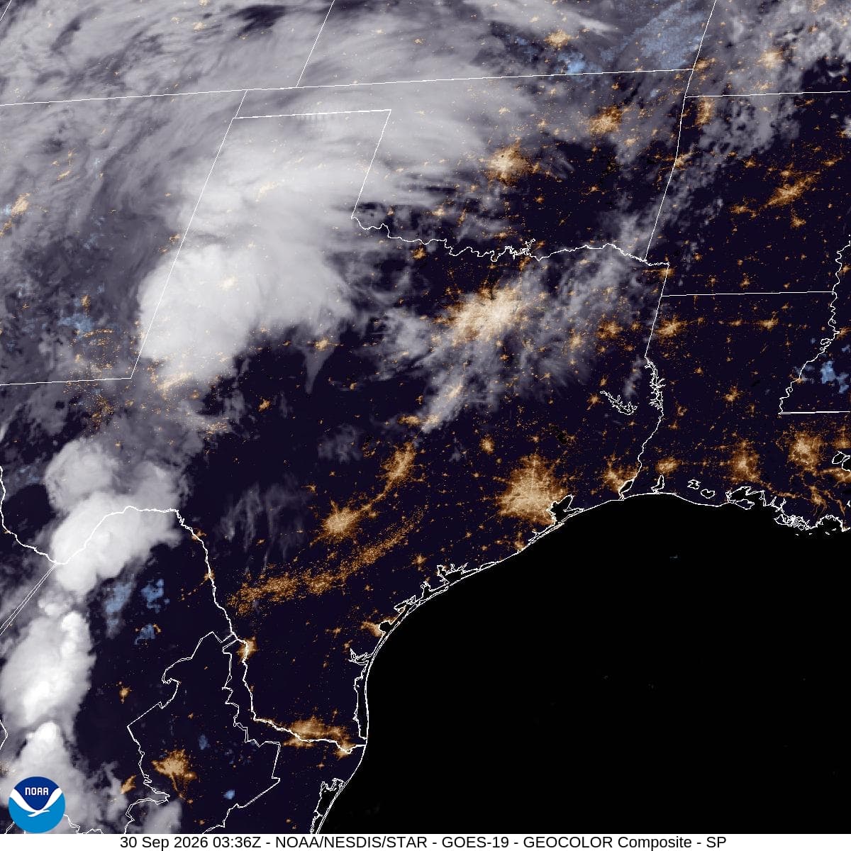
GOES-19 GeoColor satellite composite of Texas and neighboring states at 9:21 a.m. CDT September 30, 2026. Credit: NOAA/NESDIS/STAR.

Plano residents should keep weather alerts on overnight as a line of storms moves east through North Texas. Wednesday’s forecast places renewed emphasis on heavy rain continuing into Thursday, when repeated downpours could complicate travel.

Wednesday morning’s National Weather Service update puts the greatest early flood risk in western North Texas this evening, shifting toward the Interstate 35 corridor overnight and early Thursday. Plano lies farther east; the regional forecast does not establish an exact arrival time for the city.

Collin and Denton counties remain in a Flood Watch scheduled from 4 p.m. Wednesday, Sept. 30, until 7 a.m. Friday, Oct. 2. The 4:40 a.m. Wednesday update calls for 2–4 inches across the watch area, with localized totals of 5–7 inches possible. Those higher amounts are a possibility in some locations, not a prediction for every Plano neighborhood. All times are CDT.

The watch window has not changed since Tuesday’s report. The newer forecast’s higher localized rainfall estimate and overnight timing make Thursday travel worth planning now. Check current alerts before leaving, allow time to change routes and never drive into water covering a road.

A watch means flooding is possible. Keep weather alerts enabled overnight, and follow any later warnings or local barriers. Rain may become less widespread Thursday night, but additional downpours could still flood places already soaked.

Sources: National Weather Service Fort Worth/Dallas forecast discussion, updated Sept. 30 at 6:16 a.m. CDT: https://forecast.weather.gov/product.php?issuedby=fwd&product=AFD&site=fwd

Flood Watch: https://forecast.weather.gov/wwamap/wwatxtget.php?cwa=FWD&wwa=flood+watch

Current alerts: https://www.weather.gov/fwd/

Satellite image: GOES-19 GeoColor composite of the Southern Plains at 9:21 a.m. CDT Wednesday, Sept. 30, 2026. Credit: NOAA/NESDIS/STAR. This is a cloud-cover observation, not a rainfall forecast. Original: https://cdn.star.nesdis.noaa.gov/GOES19/ABI/SECTOR/sp/GEOCOLOR/20262731421_GOES19-ABI-sp-GEOCOLOR-1200x1200.jpg

Share

Plano Newsroom

Reporting from Plano and the surrounding area.

Related Stories

More in Sport

Sport

Dallas’s Touchback Choice Put Coordination Under the Microscope

Brian Schottenheimer’s Tuesday explanation of the Cowboys’ late loss to Baltimore makes the kickoff a fair target for criticism, while still giving Lamar Jackson and Zay Flowers credit for the pass that made the difference.

Una VargasSeptember 30, 20263 min read
Sport

Give Zaccharie Risacher room to be useful in Dallas

Zaccharie Risacher’s Dallas reset should begin with the work around Cooper Flagg: spacing, movement and quick decisions before a larger on-ball role is considered.

Una VargasSeptember 30, 20263 min read